StreetNav: Employing Street Cameras in Precise Navigation for Blind Pedestrians
Outcome/Accomplishment
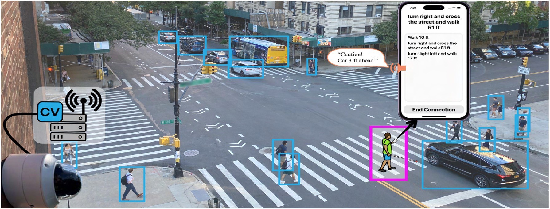
A navigation system using video from existing computer vision (CV) street cameras provided more accurate guidance for blind and low-vision pedestrians than GPS systems, according to research conducted at the Center for Smart Streetscapes (NSF CS3), a U.S. National Science Foundation (NSF)-funded Engineering Research Center (ERC) based at Columbia University
Impact/Benefits
Employing existing street cameras to help blind and low-vision (BLV) pedestrians offers significant savings over adding new cameras. The use of existing cameras also spurred fewer privacy concerns among residents and local leaders than would added cameras.
Explanation/Background
A highly interdisciplinary team developed the system, called StreetNav, that processes a camera’s video feed using computer vision and provides real-time navigation assistance through a phone app. Evaluations showed that StreetNav guides more precisely than GPS does, but its technical performance is sensitive to environmental occlusions and distance from the camera.
In interviews, community members said that using existing cameras lessened privacy concerns. The system also limited data storage to a week, alongside clear guidelines regarding access and legal use of the video footage. Most participants expressed greater trust in government entities than in corporations to manage these cameras, citing concerns about potential data exploitation by the latter.
Location
New York City, NYwebsite
Start Year
Microelectronics and IT
Microelectronics, Sensing, and IT
Lead Institution
Core Partners
Fact Sheet
Outcome/Accomplishment
A navigation system using video from existing computer vision (CV) street cameras provided more accurate guidance for blind and low-vision pedestrians than GPS systems, according to research conducted at the Center for Smart Streetscapes (NSF CS3), a U.S. National Science Foundation (NSF)-funded Engineering Research Center (ERC) based at Columbia University
Location
New York City, NYwebsite
Start Year
Microelectronics and IT
Microelectronics, Sensing, and IT
Lead Institution
Core Partners
Fact Sheet
Impact/benefits
Employing existing street cameras to help blind and low-vision (BLV) pedestrians offers significant savings over adding new cameras. The use of existing cameras also spurred fewer privacy concerns among residents and local leaders than would added cameras.
Explanation/Background
A highly interdisciplinary team developed the system, called StreetNav, that processes a camera’s video feed using computer vision and provides real-time navigation assistance through a phone app. Evaluations showed that StreetNav guides more precisely than GPS does, but its technical performance is sensitive to environmental occlusions and distance from the camera.
In interviews, community members said that using existing cameras lessened privacy concerns. The system also limited data storage to a week, alongside clear guidelines regarding access and legal use of the video footage. Most participants expressed greater trust in government entities than in corporations to manage these cameras, citing concerns about potential data exploitation by the latter.

